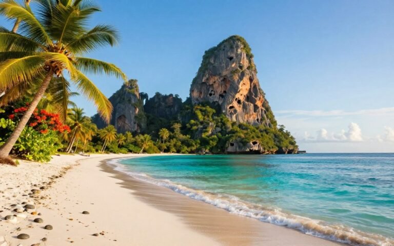
Find the best canberra city walks here. You’ll get lakeside loops, skyline lookouts and bush tracks that suit quick outings or longer adventures.
Pick a walk that fits your time and energy. Choose one for views, culture stops, or a quiet gum‑tree trail. We keep choices simple so you can decide fast.
We cover short loops around the city, steep summit routes and half‑day trails that feel like a getaway without much travel. The list is organised for mobile: quick chooser → safety basics → best routes → wrap‑up.
Are you chasing lake reflections, a sunset lookout, or a peaceful bush track before brunch? 🙂
Key Takeaways
- There’s a walk for every time frame and fitness level.
- Pick routes for views, culture stops or native bush immersion.
- Options include short loops, summit climbs and half‑day trails.
- Article layout is mobile‑friendly for fast skimming.
- Walking pairs national landmarks with natural bushland for easy discovery.
Canberra city walks at a glance: choosing the right walk for your day
Want a quick outing or a proper summit hit? Use this one-minute decision guide to match your available time with the kind of route you want. Pick flat quick loops for an easy refresh, summit options for a short, punchy challenge, or half‑day tracks when you want more bush and payoff.
Quick loops vs summit routes vs half‑day trails
- Quick loops — flat, often paved; 30–60 minutes. Great for a coffee break or a short view stop.
- Summit routes — short but steep; 60–120 minutes. Expect heart‑pumping climbs and rewarding lookouts.
- Half‑day trails — longer bush experiences; half a day for reserves and national parks.
What “easy”, “moderate” and “steep” looks like here
Easy = paved paths or gentle foreshore tracks. Moderate = steady climbs on fireroads and rocky steps. Steep = short, intense ascents that test your legs. Choose based on how much elevation you want in your experience.
Best times for views, shade and sunset
Plan by time: early morning for cool air and few people, late afternoon for golden light and sunset, and winter midday if you want warmth. Ridgelines give the best view but can be exposed. Gardens and forested tracks offer more shade and shelter.
New to local walking? Start easy, then level up once you know how the hills feel. Most routes move from urban edges into bush, so expect variety in a single walk. Happy exploring! 😊
Before you go: safety, comfort and trail etiquette in the Bush Capital
Start your outing with a quick safety and comfort check. A little organisation keeps things low stress and fun.
What to pack: water, food, phone and sun protection
Simple essentials make the difference: water, snacks, a charged phone and sun protection. Sunscreen, sunglasses and a hat matter—summer temps often pass 30°C.
Plan around daylight and sunset
Check sunset times and plan your turn-back way before dark. Give yourself margin on exposed ridgelines and fire trails.
Bush trail basics: tell someone your route
On longer or remote tracks, tell a friend your route and estimated return. This small step is vital in the bush.
- Packing tip: water, snacks, charged phone, sun protection—don’t forget a light layer. 😎
- Heat reality: exposed sections heat up fast; start early or avoid the hottest hours.
- Trail manners: keep left, pass politely and be ready for busy sections on popular paths.
- Safety habit: tell someone your route and return time when you head into the bush.
- Practical prompt: keep eye on your water level—if it falls, shorten the plan.
| Need | Why it helps | Quick tip |
|---|---|---|
| Water | Prevents dehydration in heat | Carry 500–1000ml for short walks |
| Sun protection | Blocks UV on exposed trails | Hat + sunscreen + sunglasses |
| Charged phone | Navigation and emergency contact | Load offline map and a portable charger |
| Light layer & first aid | Comfort and minor injury care | Small kit and wind/sun layer |
Final note: a little prep turns walking in the Bush Capital into an easy, low‑stress adventure. Enjoy the trail and stay curious.
Bridge to Bridge Walk around Lake Burley Griffin
If you want reliable paths, café stops and broad lake views, this route delivers. It’s the iconic inner‑edge loop around lake burley griffin that suits almost everyone, including first‑timers. 🙂
What you’ll see: national institutions, cafés and lake views
The loop is about 5km and runs beside wide water and foreshore parkland. Expect big horizons, neat lawns and plenty of places to stop for coffee.
Along the way you can drop into the National Museum of Australia, the National Gallery of Australia, the High Court of Australia and the Carillon. These make great culture add‑ons if you want to stretch the outing.
Why it’s beginner-friendly: fully cemented path
The entire circuit is fully cemented, so you can do it in runners without worrying about mud or uneven ground. That makes this one of the best short trail options for testing fitness.
Beginner tip: try walking one bridge span first. If you feel good, keep going for the full loop.
Getting there: public transport and starting near Albert Hall
Buses stop close to the foreshore, and starting near Albert Hall keeps things simple. From there the path flows clockwise or anti‑clockwise—your choice.
- Do the full loop: a neat 5km circuit for a morning or late afternoon outing.
- Shorten it: cut back at any bridge if daylight or energy is low.
Why go: this is one of the best Canberra inner‑edge routes for lake scenery without leaving the CBD edge of Lake Burley.
Weston Park foreshore strolls on Lake Burley Griffin
Weston Park is your easy‑mode lakeside escape, made for relaxed strolls and family days by the water. The 40‑hectare park blends leafy shade with a beach, water playground and picnic hubs—ideal if you want low‑pressure outdoor time. 🙂
Family‑friendly features
Playgrounds, a wading pool and a small beach keep kids happy. There are electric barbecue bays and picnic tables too, so bring food and stay a while.
Suggested loop from Karrajong Point
Start at Karrajong Point and follow the foreshore onto the West Yarralumla peninsula tracks. The 4km circuit passes The Pond, West Lane and The Ramble before a handy detour to Yarralumla Nursery and Orawa Bay.
“About 4km and roughly 45 minutes at a casual pace—add time if you picnic or linger at the playground.”
Local add‑ons and tips
Make a stop at Yarralumla Nursery, then stretch to Yarralumla Gallery and Oaks Brasserie café for coffee. If you’re short on time, do an out‑and‑back; if you feel good, complete the full trail loop.
- Why go: a leafy, relaxed take on Lake Burley Griffin with easy access and family gear.
- Time/distance: ~4km, ~45 minutes casual pace.
- Make it yours: picnic, detour to the nursery, or keep it short with an out‑and‑back.
Bottom line: Weston Park is one of the easiest ways to enjoy Lake Burley scenery without a big hike—perfect for a gentle lakeside reset.
Mount Ainslie Summit Walk (Kokoda Memorial Trail) from behind the Australian War Memorial
Want a quick summit that pairs history with a huge view? Try Mount Ainslie. The route starts behind the Australian War Memorial in Remembrance Park, so you can pair a visit with a short hike.

Trail experience
The paved trail is short‑but‑steep and very popular. Expect to share the path—around 200 people use it on busy days. Take it steady on the steep sections; this is a slow‑up, savour‑the‑view style of summit walk.
Views to look for
At the top you get a straight shot across Lake Burley Griffin to Parliament House. The geometry of the basin is clear and makes for classic photos and calm moments.
On‑trail context
The Kokoda memorial signage explains why this is called the kokoda track here. Plaques and interpretive posts add respectful context to the scenic stop.
- Pacing tip: slow your pace uphill to enjoy the memorials.
- Etiquette: keep left, call “on your right” when passing and be patient at photo points.
Why go: once you’ve done Mount Ainslie you’ll see why this summit walk is a staple Canberra lookout—short, meaningful and memorable. 😊
Black Mountain Summit Walk and forest loops
Black Mountain gives you options: a steep summit push or gentle forest loops that still feel wild.
This spot is a true choose‑your‑own intensity place. Go for the summit or pick calm loops and stay immersed among trees. 🙂
Choosing your trail
- Summit Trail — 3.5km, direct and rewarding for a short summit finish.
- Forest Track — 3.5km return, shaded and steady for a relaxed pace.
- Bushland Nature Walk / Forest Loop — 2.2km return, easy circuit with great plant spotting.
What makes it special
Black Mountain is crowned by Telstra Tower and feels like a small nature reserve near town.
Expect around 100 bird species, roughly 500 plant species, up to 5000 insect species and about 60 orchids if you look closely.
Trailheads and access
Several trail starts sit near the Australian National Botanic Gardens carpark, so logistics are simple.
Safety note: phone reception can vary under the canopy — download your map before you go.
| Trail | Distance | Vibe | Best for |
|---|---|---|---|
| Summit Trail | 3.5 km | Steep, panoramic | Quick summit, skyline photos |
| Forest Track | 3.5 km return | Shaded, steady | Birding and cool shade |
| Bushland Nature Walk / Forest Loop | 2.2 km return | Easy, intimate | Families and plant spotting |
Australian National Botanic Gardens walks at the base of Black Mountain
The Botanic Gardens offer shade, clear paths and native plants right at Black Mountain’s feet. It’s nature without the grind—great if you want flora, easy routes and calm spots to pause. 🌿
Best pick for keen walkers: Flower to Tower
The structured Flower to Tower walk covers about 5.4km return. It gives a satisfying loop with varied plant displays and a steady pace. Grab a map at the visitor centre before you start.
Kid‑friendly option: Interactive Children’s Walk
The Interactive Children’s Walk is a family favourite. Short discovery points keep kids moving and curious along the way. It’s playful, shaded and low‑stress.
Accessibility notes
There are wheelchair‑friendly routes across the 35‑hectare Gardens. Staff at the visitor centre can advise which paths suit your needs.
- Service highlight: a free electric wheelchair is available — enquire at the desk.
- Tip: do a Gardens loop first, then add a short Black Mountain trail if you feel like more.
Mount Painter Summit Walk for fast, rewarding views
A short, steep push up Mount Painter gives big views for very little time investment. The painter summit walk is a favourite for people who want a fast summit walk with a huge payoff.
Why locals love it
The painter summit is punchy and efficient. Many walkers reach the top in roughly 20 minutes, so it suits a before‑work burst or a quick afternoon escape. You get clear 360‑degree lookouts without a full‑day commitment.
Photo checklist
On a clear day frame these key views:
- Lake Burley Griffin across the basin.
- The inner skyline and lawned arts precinct.
- The distant Brindabella Range on the horizon.
Finding the start
The hardest part is the trail entrance. Some paths look like driveways and can be easy to miss.
| Trailhead | Note |
|---|---|
| Between houses 20 & 22 Booth Crescent | Local favourite, short access track |
| Bindubi Street | Easiest to locate from a map |
| Residential turnoffs | Look for narrow foottracks, not a car driveway |
Safety cue: the route tempts you to rush. Take care on steeper sections and watch your footing on the descent.
Why go: the Mount Painter summit walk is fast, rewarding and ideal when time is tight—classic for a before‑work climb or a between‑errands summit. 🙂
Shepherd’s Lookout in Woodstock Nature Reserve
Need big views with little commitment? Shepherd’s Lookout fits the bill. It’s a short and sweet bush‑view hit that delivers wide scenery without a long trek. 🙂
Easy-timeframe option: a short walk with big valley views
This is an easy ~45‑minute walk, so it’s a great add‑on to a busy day. The route is simple underfoot and family‑friendly.
What to spot: the Murrumbidgee River and distant ranges
Keep eye out for the Murrumbidgee River as it serpents through the valley. On clear days the distant ranges frame the view and make for classic photos.
- Why go: wide valley views that feel remote despite nearby suburbs.
- Setting: Woodstock Nature Reserve offers open, quiet vantage points and a true bush feel.
- Best light: late afternoon—golden low light makes the river ribbon pop.
- Practical: the point is exposed—bring water and sun protection even for a short outing.
If you like this style of lookout, you’ll probably enjoy nearby Red Hill and Mount Taylor next. For more trail notes and access info see Shepherd’s Lookout details.
Red Hill Nature Reserve ridge walks near the city
Red Hill’s ridge feels surprisingly wild despite being minutes from town. You get sweeping vantage points across Parliament House and long views toward the Brindabella Range. It’s a perfect quick escape when you want big scenery without a long drive. 🙂
Best season for colour: autumn reds and oranges
Autumn is the standout season here. Trees around the reserve glow with reds and oranges.
Bring a camera—short golden-hour windows make the colours sing.
Lookouts for different angles across Canberra and the Brindabellas
Multiple lookout points mean you can chase varied views.
Some give broad basin scenes, others frame the distant Brindabella Range. Try a circuit to sample a few angles.
Practicalities: limited shade, on‑leash dogs and golden‑hour timing
The ridge has limited shade. Carry water and sun protection, especially on warm days.
Dogs are welcome but must be on‑leash. That makes Red Hill a popular local day walk for owners.
“Close to town, feels like a proper hike — quick to reach and big on payoff.”
- Route tip: choose gentle fire trails for a steady climb or a short spur for a quicker summit.
- Best time: sunrise or sunset for soft light and quieter tracks.
- Why go: one of the best nearby nature reserve ridge experiences for big views without leaving the urban fringe.
| Feature | Note | Quick tip |
|---|---|---|
| Distance | Short circuits from 1–3 km | Combine spurs for a 2–3 km loop |
| Shade | Limited on the ridge | Wear a hat and carry 500–750 ml water |
| Dogs | On‑leash permitted | Bring a short lead for busy lookout spots |
Mount Taylor trails with views over Tuggeranong and Namadgi National Park
Mount Taylor is the southside classic for a sharp, under‑an‑hour summit that rewards effort with big outlooks. The climb is busy at peak times, but it’s short enough to squeeze into your morning or lunch time. 🙂
What to expect: a staple under‑an‑hour summit outing
Expect a steady, honest incline. The trail tests your legs, then gives a swift payoff. Most people reach the top in a bit under an hour if you keep a steady pace.
Trailhead perks: the morning coffee van vibe
One local treat is the coffee van that often sets up at the start. Walk first, then queue for caffeine—perfect post‑summit fuel. The friendly buzz at the trailhead adds a nice social note to the outing.
Panoramic pay‑off: Brindabella Range vistas
At the top you get wide views across Tuggeranong and sweeping lines to the Brindabella Range. On clear days your gaze reaches into Namadgi National Park, which helps you place the walk in the wider bush landscape.
- Local pick: the southside go‑to for a fast, reliable summit.
- Walking tip: pace the ascent, use natural breather points, then savour the panorama before you descend.
- Timing: choose cooler parts of the day—the exposed sections heat up in summer.
Mount Taylor walk guide has route notes if you want more detail. It’s one of the most efficient ways to score big views without a long hike—quick, satisfying and repeatable. 😊
One Tree Hill and the Canberra Centenary Trail connection
One Tree Hill is a great “big trail” taster that still feels achievable. It’s longer than a quick loop but not overwhelming—ideal for a relaxed half‑day adventure. 🙂
The route is part of the Canberra Centenary Trail, the 145km network that stitches together the region’s best long‑distance paths. Walking a section here gives you a clear taste of that larger trail culture.
What to expect on the way
The walk is about 8.4km return (just under 9km). Expect steady, gradual climbs and changing perspectives as you move through open ridgelines and pockets of bush. Birdlife is abundant—keep an eye and ear out for native species.
At the top
The summit rewards you with wide views and a clear selfie spot to mark the achievement. It’s a proper payoff after steady effort and a great place to pause and snack.
After‑walk reward
Start and finish near Hall village so you can pre‑load or refuel afterwards. Pop into a local café for coffee and a treat—this is one of those walks where the post‑trail stop feels earned.
- Distance: ~8.4km return — half‑day friendly.
- Vibe: gradual climbs, birdlife, steady rhythm.
- Pacing tip: settle into an easy pace uphill, snack at the top, enjoy an easier descent.
- Logistics: start near Hall; use the village as your base.
Namadgi National Park day walks for big-sky bush experiences
Namadgi National Park turns a single day into a proper escape: big horizons, quiet tracks and clear geology to explore. Start prepared and you’ll get a rewarding taste of the high country without an overnight pack. 🙂
Where to start: Namadgi Visitor Centre and trail information
Begin at the Namadgi Visitor Centre for maps, current conditions and route advice. Staff displays explain the geology and Ngunnawal stories that give the landscape deeper meaning.
Trail network overview: 160km of well‑marked walking trails
There are more than 160km of well‑marked walking trails across the park. Pick short graded loops for a relaxed day, or longer day hikes if you want a bigger outing.
What you might see: geology, flora, fauna and Ngunnawal cultural context
Expect granite ridges, wildflowers, kangaroos and abundant birdlife. Interpretive signs connect you to Ngunnawal cultural knowledge as you move through the country.
Wildlife moment: keep an eye out for wombats
Slow your pace in quieter sections and keep eye for wombats at dawn or dusk. Pack extra water, check the forecast and respect changing conditions in a national park.
Tip: even one day in Namadgi National gives a powerful taste of big‑sky bush walking — plan simply, go curious and enjoy the scale.
Booroomba Rocks in Namadgi National Park for Brindabella Range views
Booroomba Rocks rewards a short drive with dramatic Brindabella range outlooks and an unmistakable granite backdrop. The place feels properly wild—tall forest, cool air and big rock faces combine for a memorable viewpoint. 🙂
Trail choices: shorter carpark route vs longer return option
Pick a quick option from the Booroomba Rocks car park: roughly 2.5km return for a sharp viewpoint hit. It’s perfect if you’re short on time but want the payoff.
Or choose the longer route from near Honeysuckle Creek Campground. That option is about 11.5km return and gives a fuller day in the Namadgi National Park landscape.
Landscape highlights: tall forests and brooding granite cliffs
Expect tall gums and a cooler microclimate beneath the canopy. The cliffs are raw granite—they loom close and make photos dramatic.
The classic reward is wide views to the Brindabellas that feel genuinely wilderness-like.
When to go: spring wildflowers and avoiding foggy view days
Spring is prime for wildflowers and better light. Heavy cloud or early‑winter fog can wipe out visibility, so check the forecast before you drive.
- Worth-it note: Booroomba Rocks is one of the best short payoffs for dramatic outlooks nearby.
- Timing tip: allow extra time for photo stops—don’t rush the descent.
- Safety nudge: in Namadgi National Park carry more water, start early and watch conditions.
| Route | Distance | Best for |
|---|---|---|
| Carpark return | ~2.5 km | Quick viewpoint hit |
| Honeysuckle Creek return | ~11.5 km | Full day and quieter trails |
Tidbinbilla Nature Reserve walks, including Gibraltar Peak
Tidbinbilla Nature Reserve is one reserve with loads of options. It’s about a 45‑minute drive and has 22 marked trails from 15‑minute strolls to full‑day hikes.
Pick your pace: short options to longer adventures
Start small or commit to a bigger plan. Many tracks are family friendly, while others test your legs. Use the trailhead maps to match time with effort.
Gibraltar Peak Trail: the headline challenge
Gibraltar Peak is the main summit objective. The standard route is about 8.2km return and feels like a proper hike. Expect rocky sections, steady climbs and a rewarding outlook at the top.
Hanging Rock Trail: the quick “wow”
If you want a fast payoff, the Hanging Rock trail leads to a dramatic boulder lookout in under an hour. It’s perfect as a tester before you tackle a longer route. 🙂
Navigation tip: watch the small sign
A tiny sign can send you onto the scenic way. If you miss it you may join the Xanthorrhoea Loop, which still leads to Gibraltar Peak but adds distance. Either way, stay on marked paths and carry more water than for an inner suburban walk.
“Tidbinbilla rewards curiosity—start easy, then level up to the peak when you’re ready.”
- Quick choice: Hanging Rock for a short hit.
- Big day: Gibraltar Peak for a full‑effort summit.
- Prep note: bring extra water, a map and sun protection.
Googong Foreshores and the London Bridge Walking Track
A short drive out gives you a proper bush escape beside Burra Creek and Googong Dam. It’s a mini road‑trip upgrade when you want a day away without overnight planning. 🙂
Why it’s worth the drive
Googong Foreshores offers kilometres of quiet trail winding along the dam and creek. The water calms the air and the tracks feel more remote than inner options.
London Arch Bridge highlight
The London Arch Bridge is the hero: an eye‑catching granite arch with birdsong and water bubbling over rocks. Pause here and listen—the creek sound is one of the best parts.
How to walk it
Choose an 800m out‑and‑back for a quick highlight visit. If you want more, continue to complete the 2.2km loop back to the carpark.
- Quick way: out‑and‑back to the arch for a short visit.
- Longer option: 2.2km loop for more trees and creekside time.
- Group friendly: keen walkers can extend; casual visitors still get the highlight.
- Practical tip: bring insect repellent in warmer months and stay on the marked trail network.
“Pause at the bridge and listen to water over rock — it’s a small, memorable moment.”
Conclusion
Wrap your options into a real outing: pick a route that suits your energy and go enjoy the view.
With these canberra city walks you can match time, fitness and the kind of experience you want today. Choose lakeside ease around Lake Burley Griffin (hello, Burley Griffin), a fast lookout or a gentle loop.
Mount Ainslie (from behind the Australian War Memorial) is the meaningful classic. Black Mountain offers flexible trails and rich biodiversity for longer or shorter options.
When you want bigger skies, head to Namadgi National Park — a true national park for longer day treks and wide views.
Start with a short loop, step up to a summit, then try a longer trail or a section of the Canberra Centenary Trail section guide for a proper challenge.
Save this list, pick one walk for the week and try a different way of seeing the city next week. Whether at a lakeside point, on a ridge in a nature reserve, or exploring the Canberra Centenary network, you’ve now got options for every mood and pace. 🙂