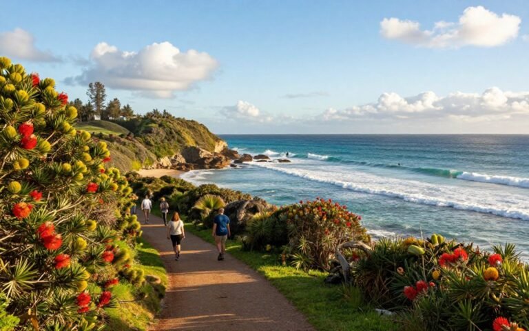
Short climb. Big payoff. Pic N’ga on the isle of pines is a compact, scenic climb that delivers a true “wow” over bright lagoons and the Pacific. You can do this in a half day and still have time to relax on the shore.
This hill is the highest point on Île des Pins, rising to about 260 metres. The route is mostly easy, with a few steeper sections and exposed rock near the finish. If you’re visiting New Caledonia, it’s one of the top viewpoints on the isle pines circuit.
What’s ahead in this guide? We’ll cover planning your trip, finding the start, following the trail, and what to do after you’re back down. Expect shade, sun, and wide sea panoramas at the top — and a couple of charming summit quirks to spot.
This is a practical, phone-friendly guide. Use it on the go if you’re already on the island or planning a short trip from Australia. Keep going when the last scramble feels “just a bit” steep — the views make it worth it. 🌊
Key Takeaways
- Pic n’ga is a short, scenic hike with big lagoon and sea views.
- Suitable for most walkers; minor rock scrambles near the top.
- Clear step-by-step planning: start point, trail, summit, return.
- Perfect half-day trip while visiting New Caledonia’s isle pines.
- Carry water, sun protection and a phone for navigation.
Before you go: planning your Isle of Pines trip from Australia
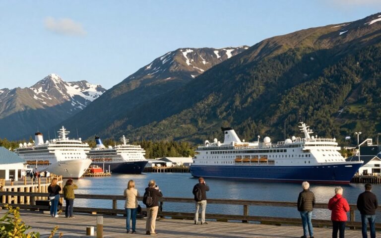
Getting to Île des Pins from Nouméa is straightforward — the typical ferry crossing takes about 2 to 2.5 hours (the Betico runs around 2 hr 15 min). Plan your day around that travel time so you don’t miss the cooler morning window for the climb.

Getting to Île des Pins from Nouméa by ferry
Simple logistics: base yourself in Nouméa and catch a ferry across. Book tickets early for peak season and cruises. Expect a calm crossing but pack a light layer for sea breezes.
Mobile-first ferry checklist
- Book ahead: ferry seat or vehicle space.
- Bring water, hat and sunscreen for arrival.
- Keep your hike flexible — arrival times can shift by an hour or two.
Best time and weather for the climb
Early morning offers cooler air and softer light. Mid-day brings strong sun on exposed sections, so start early if you can. Even cloudy days can make the walk more pleasant.
What to pack for sun, heat and an exposed trail
Non-negotiables: plenty of water, sunscreen with reapplication, a wide-brim hat and light cover for shoulders. Small coins for the summit are a quirky but handy tip from other hikers. Keep valuables zipped in pockets for steeper bits.
Footwear and fitness expectations
“It’s a pretty easy hike, but bring proper shoes — not thongs.”
The route suits most guests with a steady pace. If you feel knackered afterwards, check your hydration first — heat, not fitness, often causes that.
isle of pines pic nga: finding the trailhead and following the way up
Find the start near the narrow spit where Kuto Bay meets Kanumera. Walk along Kanumera beach in the shade of low trees until you reach a T-junction by the road.
Starting near Kuto Bay and Kanumera Bay
At the T-junction turn left, then take the immediate right fork. Watch for the pic n’ga signs that point the way inland.
Road and sign cues
After about 450 metres you’ll see the turn-off into the pic n’ga parking lot. That lot marks the real start of the walking track and is easy to spot on a phone map.
The first section through trees and a dry riverbed
The track begins shaded, winding through trees and a dry riverbed. This cool stretch helps you settle into a steady way and pace before the sun hits.
When the track opens up
After roughly 20 minutes the path opens into arid, craggy terrain. The middle and upper slopes feel steeper with occasional scree. Wear shoes with grip and take a slow, steady step for the tricky bits.
How long it takes
Typical times vary. Some guests report ~2–3 hours return. Others did about one hour up and 30 minutes down. A fast return can be around 1.5 hours depending on pace.
Safety notes
Heat and dehydration are common hazards. Drink before you feel thirsty and carry extra water on hot days.
When the trail is busy, let faster walkers pass and keep spacing on narrow sections. Slow down on steep bits — most slips happen where you rush.
At the top: highest point views, landmarks and what else to do nearby
Reach the summit and you’ll be rewarded with a sweeping lookout that stitches Kuto Bay and Upi Bay into one bright ribbon. The top is a calm spot to catch your breath and plan what comes next. Don’t rush it — the light changes fast here. 😊
Summit pay-off: panoramic views over Kuto Bay and Upi Bay
This summit sits at roughly 260–262 metres, so the views feel vast even after a short climb. From here you can trace beaches, headlands and lagoon colour in one sweep.
What you’ll see at the summit: the cross and visitor trinkets
A thick pole topped by a cross marks the highest point. Hikers often leave scarves, bracelets or small tokens. It’s a simple, friendly tradition — please leave only biodegradable items.
Upi Bay experiences: traditional pirogue rides and calm waters
Looking down, Upi Bay is noticeably quiet: no motorised vessels are allowed. If you’ve got time, try a traditional pirogue for a calm, local ride across the bay.
Island history stop: the French penal colony ruins near Ouro (west)
If history interests you, head west to Ouro. France took possession in 1853 and a penal colony began in 1872.
The Ouro water tower was built by prisoners in 1874–75 and still stands. Nearby the Cimetière des Déportés remembers deportees from 1872–1880.
More ways to explore Île des Pins: beaches, walking trails and mountain bike loops
If you’ve got a lot of time, bundle the top views with a calm Upi Bay ride and a quick Ouro stop in one relaxed day. Otherwise pick one: a beach afternoon, a peninsula walk or a short mountain bike loop around the bays.
- Quick plan: summit + Upi pirogue = half day.
- History detour: add Ouro and the ruins if you have extra hours.
- Active option: bike loops to cover more ground fast.
Further island ideas and local tips help you shape the afternoon without hurrying the view. For wider trip inspiration, see a traveller round-up here: Top short escapes.
“Pause at the cross, look out over the bays and let the place tell its story.”
Conclusion
In a few hours you can swap home routine for salty air and bright lagoon colours. Pic N’ga is one of the easiest ways to earn a big view on the isle pines and it slips neatly into a coastal day trip.
Plan for sun and carry water — the exposed sections hit harder than you expect. The route is simple: find the T-junction, take the right fork, then the parking turn-off, and follow the track on your phone.
Stand at the summit and breathe in the sea; the quiet, the light and a small token left at the cross make this place feel gentle and memorable. Respect local history and leave it better.
Want more context on reef and lagoon notes? See this reef and lagoon notes, or the view reported from the water sea view from the water. Then head to nearby beaches and bays to extend your island reset. 😊